
Thank you for supporting this site ❤️
Make a donation
Make a donation
Gear up for your next adventure:
As an Amazon Associate, this site earns from qualifying purchases at no extra cost to you.
Novés topographic map
Click on the map to display elevation.
Thank you for supporting this site ❤️
Make a donation
Make a donation
Gear up for your next adventure:
As an Amazon Associate, this site earns from qualifying purchases at no extra cost to you.
About this map
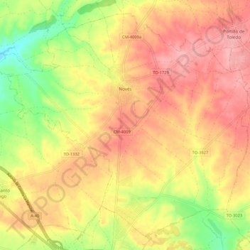
Name: Novés topographic map, elevation, terrain.
Location: Novés, Torrijos, Tolède, Castille-La Manche, 45519, Espagne (39.99740 -4.32606 40.06937 -4.22100)
Average elevation: 557 m
Minimum elevation: 489 m
Maximum elevation: 604 m
Thank you for supporting this site ❤️
Make a donation
Make a donation
Gear up for your next adventure:
As an Amazon Associate, this site earns from qualifying purchases at no extra cost to you.