
Make a donation
Gear up for your next adventure:
As an Amazon Associate, this site earns from qualifying purchases at no extra cost to you.
Big Lake topographic map
Click on the map to display elevation.
Make a donation
Gear up for your next adventure:
As an Amazon Associate, this site earns from qualifying purchases at no extra cost to you.
Big Lake
Big Lake experiences a hot semiarid climate, typical of West Texas and parts of Central Texas. Summers are long and hot, and winters are short and relatively mild. In the summer, low humidity helps temper the heat. Due to Big Lake's aridity and elevation, temperatures drop quickly after sunset, especially in the summer. Some precipitation falls in summer, mostly as fast-moving thunderstorms. Winters are dry. Winter temperatures occasionally drop below freezing at night, but sustained, bitter cold is uncommon. Snowfall is rare, never exceeds a few inches, and usually melts quickly.
Make a donation
Gear up for your next adventure:
As an Amazon Associate, this site earns from qualifying purchases at no extra cost to you.
About this map
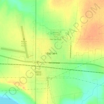
Name: Big Lake topographic map, elevation, terrain.
Location: Big Lake, Reagan County, Texas, 76932, United States (31.18253 -101.48117 31.20946 -101.42990)
Average elevation: 820 m
Minimum elevation: 798 m
Maximum elevation: 835 m
Make a donation
Gear up for your next adventure:
As an Amazon Associate, this site earns from qualifying purchases at no extra cost to you.