
Thank you for supporting this site ❤️
Make a donation
Make a donation
Gear up for your next adventure:
As an Amazon Associate, this site earns from qualifying purchases at no extra cost to you.
Madathukulam topographic map
Click on the map to display elevation.
Thank you for supporting this site ❤️
Make a donation
Make a donation
Gear up for your next adventure:
As an Amazon Associate, this site earns from qualifying purchases at no extra cost to you.
About this map
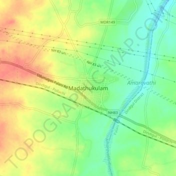
Name: Madathukulam topographic map, elevation, terrain.
Location: Madathukulam, Tiruppur District, Tamil Nadu, 642113, India (10.54076 77.34357 10.58076 77.38357)
Average elevation: 305 m
Minimum elevation: 279 m
Maximum elevation: 331 m
Thank you for supporting this site ❤️
Make a donation
Make a donation
Gear up for your next adventure:
As an Amazon Associate, this site earns from qualifying purchases at no extra cost to you.