Geolocate

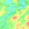
Le Breil topographic map

Click on the map to display elevation.

About this map

Name: Le Breil topographic map, elevation, terrain.

Location: Le Breil, Lamballe, Lamballe-Armor, Saint-Brieuc, Côtes-d'Armor, Bretagne, France métropolitaine, 22400, France (48.44580 -2.50193 48.48580 -2.46193)

Average elevation: 74 m

Minimum elevation: 44 m

Maximum elevation: 101 m

Other topographic maps

Click on a map to view its topography, its elevation and its terrain.

Lamballe

France > Bretagne > Côtes-d'Armor > Lamballe-Armor

Average elevation: 79 m

Morieux

France > Bretagne > Côtes-d'Armor > Lamballe-Armor

Average elevation: 64 m

Planguenoual

France > Bretagne > Côtes-d'Armor > Lamballe-Armor

Average elevation: 59 m

Meslin

France > Bretagne > Côtes-d'Armor > Lamballe-Armor

L'altitude moyenne est de 70 mètres et le climat océanique.

Average elevation: 66 m

Planguenoual

France > Bretagne > Côtes-d'Armor > Lamballe-Armor

Average elevation: 59 m

Gear up for your next adventure:

🥾Approach Shoes - Shoes designed for climbing approaches and rugged trails
💡Solar Camping Lamp - Eco-friendly lighting for campsites
🥾Hiking Shorts - Breathable shorts suitable for summer hikes
🥾Mountain Hiking Boots - High-traction boots for rocky terrain
🗺️Topographic Maps - Detailed maps to explore trails, mountains, and wilderness areas

As an Amazon Associate, this site earns from qualifying purchases at no extra cost to you.