Geolocate

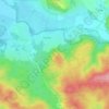
Ostrov topographic map

Click on the map to display elevation.

About this map

Name: Ostrov topographic map, elevation, terrain.

Location: Ostrov, okres Příbram, Central Bohemian Region, Central Bohemia, Czechia (49.60204 14.00274 49.63156 14.02860)

Average elevation: 528 m

Minimum elevation: 484 m

Maximum elevation: 586 m

Other topographic maps

Click on a map to view its topography, its elevation and its terrain.

Studce

Czechia > Central Bohemian Region

Average elevation: 235 m

Trojhran

Czechia > Central Bohemian Region > Žehrov

Average elevation: 285 m

Mezivrata

Czechia > Central Bohemian Region > Neustupov

Average elevation: 630 m

Gear up for your next adventure:

🎒Fully Waterproof Backpack - Total protection for photography gear and electronics
👟Leg Gaiters - Keep debris, mud, and snow out of your boots
📷Outdoor Action Camera - Capture high-elevation views and rugged adventures
🏕️Camping Hammock - Integrated protection for sleeping between trees
🛏️Sleeping Bag - Warm and compact sleeping bags for outdoor camping

As an Amazon Associate, this site earns from qualifying purchases at no extra cost to you.