Geolocate

Kisima topographic map

Click on the map to display elevation.

About this map

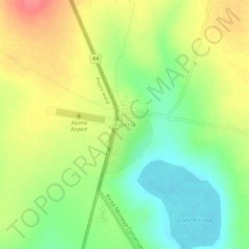
Name: Kisima topographic map, elevation, terrain.

Location: Kisima, Lodokejek ward, Samburu Central, Samburu, Kenya (0.92741 36.74571 0.96741 36.78571)

Average elevation: 1,792 m

Minimum elevation: 1,760 m

Maximum elevation: 1,827 m

Gear up for your next adventure:

💡Solar Camping Lamp - Eco-friendly lighting for campsites
🍽️Titanium Camping Spork - Ultralight and indestructible eating utensil
🌡️Emergency Mylar Blankets - Compact thermal protection for unexpected nights outdoors
🧣Evaporative Cooling Towel - Beat the heat during intense summer climbs
🧥Ultralight Puffy Jacket - Maximum warmth that packs down to the size of an orange

As an Amazon Associate, this site earns from qualifying purchases at no extra cost to you.