
Thank you for supporting this site ❤️
Make a donation
Make a donation
Gear up for your next adventure:
As an Amazon Associate, this site earns from qualifying purchases at no extra cost to you.
Amritwasi topographic map
Click on the map to display elevation.
Thank you for supporting this site ❤️
Make a donation
Make a donation
Gear up for your next adventure:
As an Amazon Associate, this site earns from qualifying purchases at no extra cost to you.
About this map
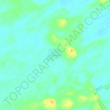
Name: Amritwasi topographic map, elevation, terrain.
Location: Amritwasi, Sri Dungargarh Tehsil, Bikaner, Rajasthan, India (27.95830 74.19737 27.99830 74.23737)
Average elevation: 303 m
Minimum elevation: 294 m
Maximum elevation: 329 m
Thank you for supporting this site ❤️
Make a donation
Make a donation
Gear up for your next adventure:
As an Amazon Associate, this site earns from qualifying purchases at no extra cost to you.