
Thank you for supporting this site ❤️
Make a donation
Make a donation
Gear up for your next adventure:
As an Amazon Associate, this site earns from qualifying purchases at no extra cost to you.
Seoni-Malwa Tahsil topographic map
Click on the map to display elevation.
Thank you for supporting this site ❤️
Make a donation
Make a donation
Gear up for your next adventure:
As an Amazon Associate, this site earns from qualifying purchases at no extra cost to you.
About this map
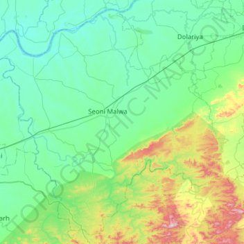
Name: Seoni-Malwa Tahsil topographic map, elevation, terrain.
Location: Seoni-Malwa Tahsil, Hoshangabad, Madhya Pradesh, India (22.21395 77.21239 22.64801 77.71944)
Average elevation: 364 m
Minimum elevation: 268 m
Maximum elevation: 780 m
Thank you for supporting this site ❤️
Make a donation
Make a donation
Gear up for your next adventure:
As an Amazon Associate, this site earns from qualifying purchases at no extra cost to you.