
Thank you for supporting this site ❤️
Make a donation
Make a donation
Gear up for your next adventure:
As an Amazon Associate, this site earns from qualifying purchases at no extra cost to you.
Aurangabad topographic map
Click on the map to display elevation.
Thank you for supporting this site ❤️
Make a donation
Make a donation
Gear up for your next adventure:
As an Amazon Associate, this site earns from qualifying purchases at no extra cost to you.
About this map
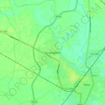
Name: Aurangabad topographic map, elevation, terrain.
Location: Aurangabad, Maunath Bhanjan, Mau, Uttar Pradesh, 275101, India (25.92364 83.50247 26.00364 83.58247)
Average elevation: 71 m
Minimum elevation: 64 m
Maximum elevation: 75 m
Thank you for supporting this site ❤️
Make a donation
Make a donation
Gear up for your next adventure:
As an Amazon Associate, this site earns from qualifying purchases at no extra cost to you.