
Thank you for supporting this site ❤️
Make a donation
Make a donation
Gear up for your next adventure:
As an Amazon Associate, this site earns from qualifying purchases at no extra cost to you.
Alsask topographic map
Click on the map to display elevation.
Thank you for supporting this site ❤️
Make a donation
Make a donation
Gear up for your next adventure:
As an Amazon Associate, this site earns from qualifying purchases at no extra cost to you.
About this map
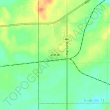
Name: Alsask topographic map, elevation, terrain.
Location: Alsask, Milton No. 292, Saskatchewan, S0L 0A0, Canada (51.35551 -110.01560 51.39551 -109.97560)
Average elevation: 703 m
Minimum elevation: 685 m
Maximum elevation: 735 m
Milton No. 292 trails, hiking, mountain biking, running and outdoor activities
Thank you for supporting this site ❤️
Make a donation
Make a donation
Gear up for your next adventure:
As an Amazon Associate, this site earns from qualifying purchases at no extra cost to you.