
Hintertux topographic map
Interactive map
Click on the map to display elevation.
About this map
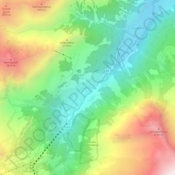
Name: Hintertux topographic map, elevation, terrain.
Location: Hintertux, Schwaz, Tyrol, A-6293, Austria (47.09509 11.66201 47.13509 11.70201)
Average elevation: 1,951 m
Minimum elevation: 1,372 m
Maximum elevation: 2,888 m