Geolocate

Ohu topographic map

Click on the map to display elevation.

About this map
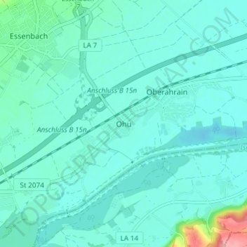
Name: Ohu topographic map, elevation, terrain.

Location: Ohu, Essenbach, Landkreis Landshut, Bavaria, 84051, Germany (48.57873 12.22031 48.61873 12.26031)

Average elevation: 384 m

Minimum elevation: 367 m

Maximum elevation: 486 m

Gear up for your next adventure:

🔦LED Headtorch - Bright and durable light for night activities
🥾Trail Hiking Shoes - Durable shoes designed for rugged trails
💧Reusable Water Bottle - Durable water bottles for hydration on trails
🧭GPS Outdoor Watch - Smart watch for navigation and fitness tracking in nature
🛁Quick-Dry Microfiber Towel - Space-saving towel that dries rapidly on the move

As an Amazon Associate, this site earns from qualifying purchases at no extra cost to you.