Geolocate

Patriching topographic map

Click on the map to display elevation.

About this map
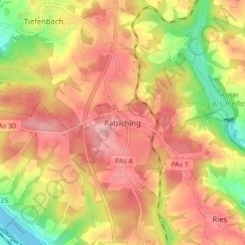
Name: Patriching topographic map, elevation, terrain.

Location: Patriching, Passau, Bayern, 94034, Deutschland (48.58715 13.39905 48.62715 13.43905)

Average elevation: 386 m

Minimum elevation: 294 m

Maximum elevation: 451 m

Gear up for your next adventure:

🕶️Polarized Sunglasses - Reduces glare from snow and water at high elevations
🧳Compression Sacks - Maximize space in your backpack by shrinking gear
🚲Bike Repair Kit - Essential tools for on-trail mechanical issues
🩹Moleskin Blister Pads - Direct protection for painful foot pressure points
🛶Waterproof Dry Bags - Keep electronics and clothes dry during river crossings

As an Amazon Associate, this site earns from qualifying purchases at no extra cost to you.