Geolocate

Espierba topographic map

Click on the map to display elevation.

About this map

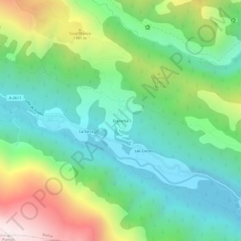
Name: Espierba topographic map, elevation, terrain.

Location: Espierba, Bielsa, Sobrarbe, Huesca, Aragón, España (42.63066 0.13613 42.67066 0.17613)

Average elevation: 1,612 m

Minimum elevation: 1,154 m

Maximum elevation: 2,601 m

Gear up for your next adventure:

🥽Outdoor Goggles - Protective eyewear for outdoor activities
🛶Waterproof Dry Bags - Keep electronics and clothes dry during river crossings
🛌Insulated Sleeping Pad - Critical thermal barrier between you and the cold ground
Camping Groundsheet - Protect your tent from moisture and dirt
🎒Hiking Backpack - Lightweight and ergonomic backpacks for day hikes or multi-day treks

As an Amazon Associate, this site earns from qualifying purchases at no extra cost to you.