Geolocate

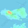
Resang topographic map

Click on the map to display elevation.

About this map

Name: Resang topographic map, elevation, terrain.

Location: Resang, Lingga, Riau Islands, Indonesia (-0.66209 104.36645 -0.62209 104.40645)

Average elevation: 9 m

Minimum elevation: -1 m

Maximum elevation: 88 m

Other topographic maps

Click on a map to view its topography, its elevation and its terrain.
Pulau Duyung

Indonesia > Riau Islands > Lingga

Average elevation: 2 m

Pulau Selayar

Indonesia > Riau Islands > Lingga > Penuba

Average elevation: 10 m

Gear up for your next adventure:

🥾Hiking Leggings - Comfortable leggings for outdoor activities
🎒Fully Waterproof Backpack - Total protection for photography gear and electronics
🧥Waterproof Hiking Jacket - Protect yourself from rain and wind while hiking
👟Trail Running Shoes - Agile footwear for fast-paced topographic exploration
💧Hydration Pack - Hands-free hydration system for long hikes

As an Amazon Associate, this site earns from qualifying purchases at no extra cost to you.