Geolocate

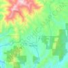
Weaverville topographic map

Click on the map to display elevation.

About this map

Name: Weaverville topographic map, elevation, terrain.

Location: Weaverville, Trinity County, California, United States (40.68521 -122.96867 40.80171 -122.90021)

Average elevation: 893 m

Minimum elevation: 518 m

Maximum elevation: 2,113 m

Other topographic maps

Click on a map to view its topography, its elevation and its terrain.
Gear up for your next adventure:

🛶Waterproof Dry Bags - Keep electronics and clothes dry during river crossings
🥾Lightweight Hiking Boots - Boots for comfort and mobility on long hikes
🧼Travel Hand Sanitizer - Keep hands clean when water is scarce
💧Hydration Pack - Hands-free hydration system for long hikes
🧥Waterproof Jacket - Lightweight rain jackets for hiking and outdoor activities

As an Amazon Associate, this site earns from qualifying purchases at no extra cost to you.