
Kryvyï Rih topographic map
Interactive map
Click on the map to display elevation.
About this map
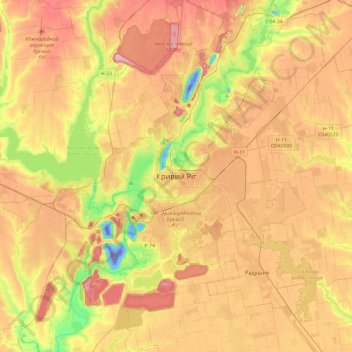
Name: Kryvyï Rih topographic map, elevation, terrain.
Average elevation: 92 m
Minimum elevation: -221 m
Maximum elevation: 175 m
Other topographic maps
Click on a map to view its topography, its elevation and its terrain.
Металургійний район
Ukraine > Oblast de Dnipropetrovsk > Kryvyï Rih
Металургійний район, Kryvyï Rih, Криворізька міська громада, Криворізький район, Oblast de Dnipropetrovsk, Ukraine
Average elevation: 89 m