
Lingk. Bukit Ngandang topographic map
Interactive map
Click on the map to display elevation.
About this map
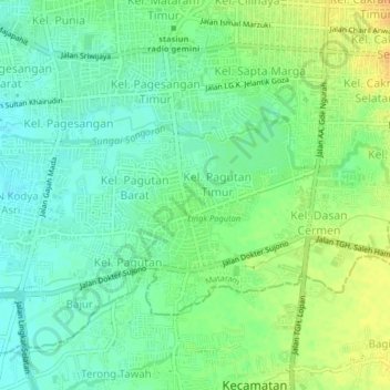
Name: Lingk. Bukit Ngandang topographic map, elevation, terrain.
Average elevation: 20 m
Minimum elevation: 7 m
Maximum elevation: 39 m
Other topographic maps
Click on a map to view its topography, its elevation and its terrain.
BTN Kekalik
Indonesia > West Nusa Tenggara > Kec. Mataram > Mataram
BTN Kekalik, Mataram, Kec. Mataram, West Nusa Tenggara, Lesser Sunda Islands, 83115, Indonesia
Average elevation: 13 m