Geolocate

Drapel topographic map

Click on the map to display elevation.

About this map

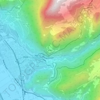
Name: Drapel topographic map, elevation, terrain.

Location: Drapel, Aigle, District d'Aigle, Vaud, 1860, Switzerland (46.30059 6.96294 46.34059 7.00294)

Average elevation: 716 m

Minimum elevation: 385 m

Maximum elevation: 1,547 m

Gear up for your next adventure:

🥾Mountain Hiking Shoes - Shoes with superior grip for mountainous terrain
🥾Hiking Gaiters - Protect legs and shoes from mud, snow, and debris
🧥Softshell Hiking Jacket - The perfect balance of wind protection and breathability
🧭GPS Outdoor Watch - Smart watch for navigation and fitness tracking in nature
🥾Approach Boots - Comfortable boots for hiking and climbing approaches

As an Amazon Associate, this site earns from qualifying purchases at no extra cost to you.