Geolocate

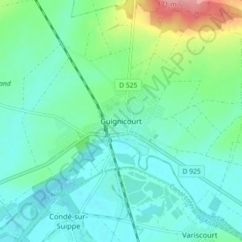
Guignicourt topographic map

Click on the map to display elevation.

Guignicourt

La superficie de la commune est de 1 774 hectares ; son altitude varie de 51 à 142 mètres.

Wikipedia (CC-BY-SA 3.0)

About this map

Name: Guignicourt topographic map, elevation, terrain.

Location: Guignicourt, Villeneuve-sur-Aisne, Laon, Aisne, Hauts-de-France, France métropolitaine, 02190, France (49.41624 3.94500 49.45624 3.98500)

Average elevation: 73 m

Minimum elevation: 50 m

Maximum elevation: 153 m

Other topographic maps

Click on a map to view its topography, its elevation and its terrain.

Guignicourt

France > Hauts-de-France > Aisne > Villeneuve-sur-Aisne

La superficie de la commune est de 1 774 hectares ; son altitude varie de 51 à 142 mètres.

Average elevation: 82 m

Gear up for your next adventure:

☕Camping Coffee Maker - Brew fresh coffee anywhere on the topographic map
🧢Outdoor Visor - Breathable visor for sunny hikes
🧼Travel Hand Sanitizer - Keep hands clean when water is scarce
💧Hydration Bladder - Hands-free hydration solution for long treks
🏕️Camping Hammock - Integrated protection for sleeping between trees

As an Amazon Associate, this site earns from qualifying purchases at no extra cost to you.