
Make a donation
Gear up for your next adventure:
As an Amazon Associate, this site earns from qualifying purchases at no extra cost to you.
Jungingen topographic map
Click on the map to display elevation.
Make a donation
Gear up for your next adventure:
As an Amazon Associate, this site earns from qualifying purchases at no extra cost to you.
Jungingen
Das 2005 erbaute Getreidesilo der Schapfenmühle ist mit 114,6 m Höhe das höchste in Betrieb befindliche Getreidesilo der Welt. Das Silo ist das dritthöchste Bauwerk in Ulm, nach dem Fernmeldeturm Ermingen mit 162 m und dem Ulmer Münster mit 161,53 m.
Make a donation
Gear up for your next adventure:
As an Amazon Associate, this site earns from qualifying purchases at no extra cost to you.
About this map
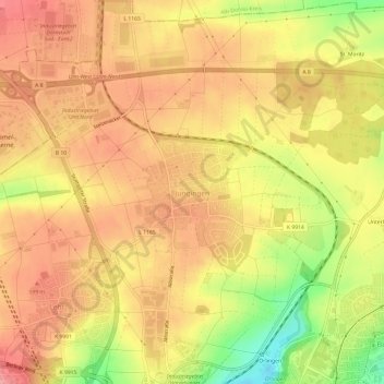
Name: Jungingen topographic map, elevation, terrain.
Location: Jungingen, Ulm, Baden-Württemberg, 89075, Deutschland (48.42513 9.96975 48.46513 10.00975)
Average elevation: 579 m
Minimum elevation: 512 m
Maximum elevation: 616 m
Make a donation
Gear up for your next adventure:
As an Amazon Associate, this site earns from qualifying purchases at no extra cost to you.