Geolocate

Mindelheim topographic map

Click on the map to display elevation.

About this map

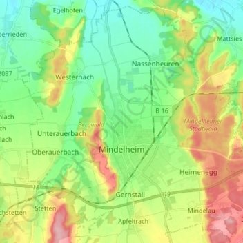
Name: Mindelheim topographic map, elevation, terrain.

Location: Mindelheim, Landkreis Unterallgäu, Bavaria, 87719, Germany (48.01370 10.43465 48.09898 10.56706)

Average elevation: 615 m

Minimum elevation: 569 m

Maximum elevation: 694 m

Other topographic maps

Click on a map to view its topography, its elevation and its terrain.

Gear up for your next adventure:

🥫Freeze-Dried Meals - Lightweight, high-calorie nutrition for multi-day treks
Camping Essentials - All-in-one gear for a comfortable camping trip
Tent Footprint - Protect tent floor and increase durability
🥾Hiking Shorts - Breathable shorts suitable for summer hikes
🥾Trekking Poles - Adjustable trekking poles to reduce knee stress and improve stability

As an Amazon Associate, this site earns from qualifying purchases at no extra cost to you.