
Make a donation
Gear up for your next adventure:
As an Amazon Associate, this site earns from qualifying purchases at no extra cost to you.
Volcán de Tajogaite topographic map
Click on the map to display elevation.
Make a donation
Gear up for your next adventure:
As an Amazon Associate, this site earns from qualifying purchases at no extra cost to you.
Volcán de Tajogaite
Con la llegada de la colada al mar el 29 de septiembre, se produjo una nube de gases tóxicos, formada fundamentalmente por ácido sulfúrico (H2SO4), ácido clorhídrico (HCl) y ácido fluorhídrico (HF). También se produjo una elevación de la temperatura del agua, al recibir la lava a más de 1000 °C.
Make a donation
Gear up for your next adventure:
As an Amazon Associate, this site earns from qualifying purchases at no extra cost to you.
About this map
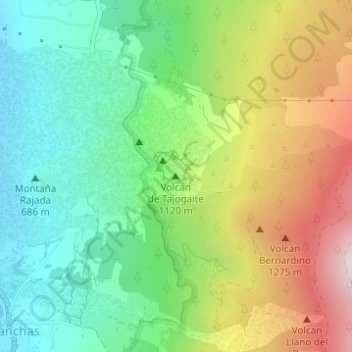
Name: Volcán de Tajogaite topographic map, elevation, terrain.
Average elevation: 940 m
Minimum elevation: 586 m
Maximum elevation: 1,525 m
Make a donation
Gear up for your next adventure:
As an Amazon Associate, this site earns from qualifying purchases at no extra cost to you.