
Thank you for supporting this site ❤️
Make a donation
Make a donation
Gear up for your next adventure:
As an Amazon Associate, this site earns from qualifying purchases at no extra cost to you.
Surimana topographic map
Click on the map to display elevation.
Thank you for supporting this site ❤️
Make a donation
Make a donation
Gear up for your next adventure:
As an Amazon Associate, this site earns from qualifying purchases at no extra cost to you.
About this map
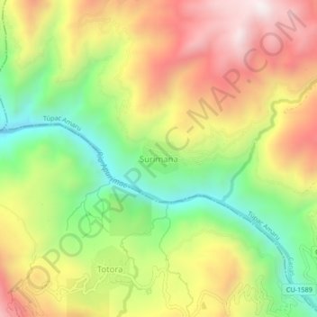
Name: Surimana topographic map, elevation, terrain.
Location: Surimana, Túpac Amaru, Provincia de Canas, Cuzco, Perú (-14.17346 -71.59500 -14.13346 -71.55500)
Average elevation: 3,635 m
Minimum elevation: 3,193 m
Maximum elevation: 4,106 m
Thank you for supporting this site ❤️
Make a donation
Make a donation
Gear up for your next adventure:
As an Amazon Associate, this site earns from qualifying purchases at no extra cost to you.