Geolocate

Vassena topographic map

Click on the map to display elevation.

About this map

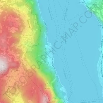
Name: Vassena topographic map, elevation, terrain.

Location: Vassena, Oliveto Lario, Lecco, Lombardy, 23865, Italy (45.91054 9.26474 45.95054 9.30474)

Average elevation: 426 m

Minimum elevation: 188 m

Maximum elevation: 994 m

Gear up for your next adventure:

🥾Mountaineering Boots - Supportive boots for climbing and high-altitude hiking
🥾Trail Running Boots - Durable shoes designed for trail running
Camping Coffee Maker - Brew fresh coffee anywhere on the topographic map
🚲Heavy Duty Bike Lock - Secure your bike at the trailhead or during stops
🧴Insect Repellent - Protect yourself from bugs during outdoor adventures

As an Amazon Associate, this site earns from qualifying purchases at no extra cost to you.