Geolocate

Combayo topographic map

Click on the map to display elevation.

About this map

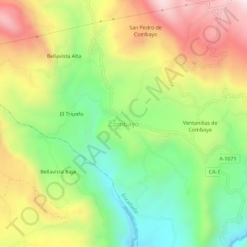
Name: Combayo topographic map, elevation, terrain.

Location: Combayo, Encañada, Provincia de Cajamarca, Cajamarca, Perú (-7.05136 -78.43401 -7.01136 -78.39401)

Average elevation: 3,307 m

Minimum elevation: 2,966 m

Maximum elevation: 3,728 m

Gear up for your next adventure:

🧭GPS Tracker - Track your location in remote areas safely
🧤Thermal Hiking Gloves - Grip-enhanced gloves for cold-weather altitude trekking
🥾Hiking Gaiters - Protect legs and shoes from mud, snow, and debris
🍽️Titanium Camping Spork - Ultralight and indestructible eating utensil
👟Trail Running Shoes - Agile footwear for fast-paced topographic exploration

As an Amazon Associate, this site earns from qualifying purchases at no extra cost to you.