Geolocate

Pedret topographic map

Click on the map to display elevation.

About this map

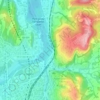
Name: Pedret topographic map, elevation, terrain.

Location: Pedret, Gerona, Gironés, Gerona, Cataluña, España (41.98944 2.82276 41.99785 2.82710)

Average elevation: 107 m

Minimum elevation: 54 m

Maximum elevation: 219 m

Gear up for your next adventure:

🎒Backpack Rain Cover - External shield to keep your entire pack dry
🏕️Camping Hammock - Integrated protection for sleeping between trees
🥤Collapsible Travel Cup - Saves space and weight in your mess kit
🧢Hiking Sun Hat - Wide-brimmed protection for exposed mountain ridges
Camping Tent - Weather-resistant tents suitable for 2 to 6 people

As an Amazon Associate, this site earns from qualifying purchases at no extra cost to you.