
Stokkum topographic map
Interactive map
Click on the map to display elevation.
About this map
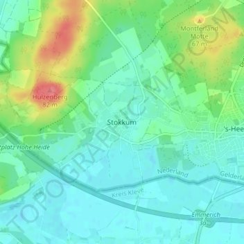
Name: Stokkum topographic map, elevation, terrain.
Location: Stokkum, Geldern, Niederlande, 7039, Niederlande (51.85903 6.20148 51.89903 6.24148)
Average elevation: 28 m
Minimum elevation: 11 m
Maximum elevation: 78 m