Geolocate

Gomukh topographic map

Click on the map to display elevation.

About this map

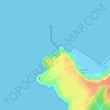
Name: Gomukh topographic map, elevation, terrain.

Location: Gomukh, Jaigarh, Ratnagiri, Maharashtra, India (17.30465 73.19448 17.30469 73.19452)

Average elevation: 7 m

Minimum elevation: 0 m

Maximum elevation: 48 m

Gear up for your next adventure:

🧥Thermal Fleece Jacket - Versatile insulation for changing mountain temperatures
🥫Freeze-Dried Meals - Lightweight, high-calorie nutrition for multi-day treks
🩹Moleskin Blister Pads - Direct protection for painful foot pressure points
💧Filtered Water Bottle - Safe drinking water on the go
🥾Trekking Boots - Durable boots for long-distance trekking

As an Amazon Associate, this site earns from qualifying purchases at no extra cost to you.