Geolocate

Nuzvid topographic map

Click on the map to display elevation.

About this map

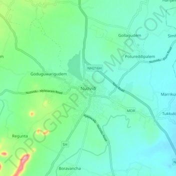
Name: Nuzvid topographic map, elevation, terrain.

Location: Nuzvid, Eluru District, Andhra Pradesh, 521200, India (16.75070 80.80761 16.83070 80.88761)

Average elevation: 107 m

Minimum elevation: 69 m

Maximum elevation: 257 m

Gear up for your next adventure:

🛶Waterproof Dry Bags - Keep electronics and clothes dry during river crossings
❄️Traction Ice Cleats - Slip-on spikes for icy trails and winter hiking
🥾Hiking Gaiters - Protect legs and shoes from mud, snow, and debris
🧢Outdoor Visor - Breathable visor for sunny hikes
💡Solar Camping Lamp - Eco-friendly lighting for campsites

As an Amazon Associate, this site earns from qualifying purchases at no extra cost to you.