
Winchendon topographic map
Click on the map to display elevation.
About this map
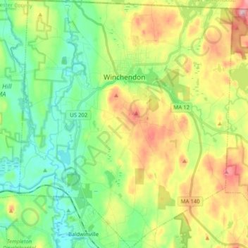
Name: Winchendon topographic map, elevation, terrain.
Average elevation: 311 m
Minimum elevation: 243 m
Maximum elevation: 428 m
Other topographic maps
Click on a map to view its topography, its elevation and its terrain.
South Barre
United States > Massachusetts > Worcester County > Barre > South Barre
Average elevation: 223 m