
Kuujjuarapik topographic map
Interactive map
Click on the map to display elevation.
About this map
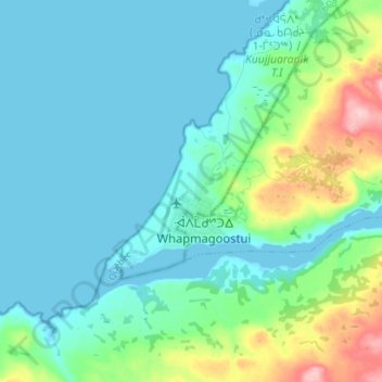
Name: Kuujjuarapik topographic map, elevation, terrain.
Location: Kuujjuarapik, Kativik, Nord-du-Québec, Quebec, Canada (55.24460 -77.79765 55.32460 -77.71765)
Average elevation: 32 m
Minimum elevation: -3 m
Maximum elevation: 167 m