Geolocate

Freires topographic map

Click on the map to display elevation.

About this map

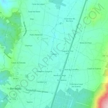
Name: Freires topographic map, elevation, terrain.

Location: Freires, Benedita, Alcobaça, Leiria, 2475-029, Portugal (39.41849 -8.98165 39.45849 -8.94165)

Average elevation: 203 m

Minimum elevation: 145 m

Maximum elevation: 431 m

Gear up for your next adventure:

🥤Collapsible Travel Cup - Saves space and weight in your mess kit
🏃Hydration Running Vest - Carry water and maps close to your body for speed
🧭GPS Handheld Device - Reliable GPS navigation for outdoor adventures
🥾Lightweight Hiking Boots - Boots for comfort and mobility on long hikes
🧥Packable Rain Jacket - Breathable waterproof layer for unpredictable weather

As an Amazon Associate, this site earns from qualifying purchases at no extra cost to you.