Geolocate

Strekov topographic map

Click on the map to display elevation.

Strekov

The municipality lies at an altitude of 132 metres and covers an area of 41.055 km.

Wikipedia (CC-BY-SA 3.0)

About this map

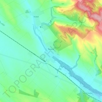
Name: Strekov topographic map, elevation, terrain.

Location: Strekov, District of Nové Zámky, Region of Nitra, Western Slovakia, 941 37, Slovakia (47.86548 18.34522 47.93940 18.46029)

Average elevation: 163 m

Minimum elevation: 121 m

Maximum elevation: 277 m

Gear up for your next adventure:

🦶Hiking Shoe Insoles - Added support for high arches and long days on feet
🥾Light Hiking Boots - Lightweight and comfortable boots for day hikes
🔋Lithium AA Batteries - Long-lasting power that performs in extreme cold
🦶Anti-Blister Balm - Prevents friction and hotspots during long ascents
🥾Trekking Boots - Durable boots for long-distance trekking

As an Amazon Associate, this site earns from qualifying purchases at no extra cost to you.