Geolocate

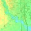
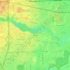
Southgate topographic map

Click on the map to display elevation.

About this map

Name: Southgate topographic map, elevation, terrain.

Location: Southgate, Wayne County, Michigan, 48195, United States (42.18428 -83.22986 42.22801 -83.17959)

Average elevation: 182 m

Minimum elevation: 178 m

Maximum elevation: 188 m

Other topographic maps

Click on a map to view its topography, its elevation and its terrain.
Perrinville

United States > Michigan > Wayne County > Westland

Average elevation: 195 m

Palmer Park

United States > Michigan > Wayne County > Detroit

Average elevation: 198 m

Sunnyside

United States > Michigan > Wayne County > Romulus

Average elevation: 194 m

Elm

United States > Michigan > Wayne County > Livonia

Average elevation: 195 m

Calvert Park

United States > Michigan > Wayne County > Detroit

Average elevation: 196 m

Newburg

United States > Michigan > Wayne County > Livonia

Average elevation: 209 m

Gear up for your next adventure:

🪑Insulated Seat Pad - Protect your seat from cold rocks and wet logs
🪑Ultralight Camping Stool - Compact seating for rest stops during long hikes
🦌Outdoor Trail Camera - Monitor wildlife activity near your favorite spots
🎒Hiking Backpack - Lightweight and ergonomic backpacks for day hikes or multi-day treks
🌡️Emergency Mylar Blankets - Compact thermal protection for unexpected nights outdoors

As an Amazon Associate, this site earns from qualifying purchases at no extra cost to you.