
Thank you for supporting this site ❤️
Make a donation
Make a donation
Gear up for your next adventure:
As an Amazon Associate, this site earns from qualifying purchases at no extra cost to you.
Cokotin topographic map
Click on the map to display elevation.
Thank you for supporting this site ❤️
Make a donation
Make a donation
Gear up for your next adventure:
As an Amazon Associate, this site earns from qualifying purchases at no extra cost to you.
About this map
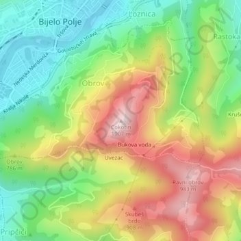
Name: Cokotin topographic map, elevation, terrain.
Location: Cokotin, Obrov, Bijelo Polje Municipality, 84000, Montenegro (43.02289 19.75661 43.02299 19.75671)
Average elevation: 745 m
Minimum elevation: 555 m
Maximum elevation: 990 m
Thank you for supporting this site ❤️
Make a donation
Make a donation
Gear up for your next adventure:
As an Amazon Associate, this site earns from qualifying purchases at no extra cost to you.