Geolocate

Knislinge topographic map

Click on the map to display elevation.

About this map

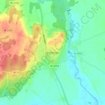
Name: Knislinge topographic map, elevation, terrain.

Location: Knislinge, Östra Göinge kommun, Skåne County, 289 31, Sweden (56.17420 14.06514 56.21420 14.10514)

Average elevation: 33 m

Minimum elevation: 12 m

Maximum elevation: 74 m

Other topographic maps

Click on a map to view its topography, its elevation and its terrain.

Malmo

Sweden > Skåne County

Average elevation: 10 m

Gear up for your next adventure:

💡LED Camping Lantern - Illuminate your campsite with long-lasting lanterns
Bushcraft Tarp - Versatile emergency shelter or gear protection
🦌Outdoor Trail Camera - Monitor wildlife activity near your favorite spots
🛶Kayak Accessories - Essential gear for safe and fun kayaking adventures
🔭Compact Binoculars - Lightweight optics for scouting trails and wildlife

As an Amazon Associate, this site earns from qualifying purchases at no extra cost to you.