Geolocate

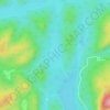
Lac Courtin topographic map

Click on the map to display elevation.

About this map

Name: Lac Courtin topographic map, elevation, terrain.

Location: Lac Courtin, Lac-Croche, La Jacques-Cartier, Capitale-Nationale, Québec, Canada (47.67657 -72.02209 47.67953 -72.01890)

Average elevation: 512 m

Minimum elevation: 460 m

Maximum elevation: 583 m

Other topographic maps

Click on a map to view its topography, its elevation and its terrain.

Lac Sioui

Canada > Québec > La Jacques-Cartier > Lac-Croche

Average elevation: 711 m

Lac Brûlé

Canada > Québec > La Jacques-Cartier > Lac-Croche

Average elevation: 530 m

Gear up for your next adventure:

⛺Lightweight Backpacking Tent - Compact tent for efficient hiking trips
🧊Insulated Water Bottle - Keeps drinks cold in summer and prevents freezing in winter
🛶Waterproof Dry Bags - Keep electronics and clothes dry during river crossings
🧴Waterproofing Spray - Restore the DWR coating on jackets and tents
🕯️Camping Lantern - Illuminates your entire campsite with high-efficiency LEDs

As an Amazon Associate, this site earns from qualifying purchases at no extra cost to you.