
Thank you for supporting this site ❤️
Make a donation
Make a donation
Gear up for your next adventure:
As an Amazon Associate, this site earns from qualifying purchases at no extra cost to you.
Cegni topographic map
Click on the map to display elevation.
Thank you for supporting this site ❤️
Make a donation
Make a donation
Gear up for your next adventure:
As an Amazon Associate, this site earns from qualifying purchases at no extra cost to you.
About this map
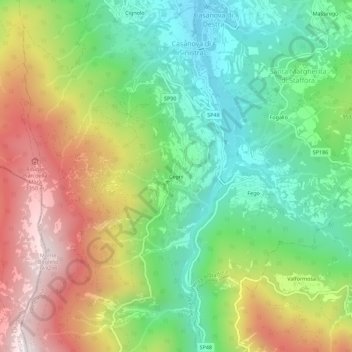
Name: Cegni topographic map, elevation, terrain.
Location: Cegni, Santa Margherita di Staffora, Pavia, Lombardy, Italy (44.73337 9.21510 44.77337 9.25510)
Average elevation: 927 m
Minimum elevation: 540 m
Maximum elevation: 1,495 m
Thank you for supporting this site ❤️
Make a donation
Make a donation
Gear up for your next adventure:
As an Amazon Associate, this site earns from qualifying purchases at no extra cost to you.