
Thank you for supporting this site ❤️
Make a donation
Make a donation
Gear up for your next adventure:
As an Amazon Associate, this site earns from qualifying purchases at no extra cost to you.
Çevreköy topographic map
Click on the map to display elevation.
Thank you for supporting this site ❤️
Make a donation
Make a donation
Gear up for your next adventure:
As an Amazon Associate, this site earns from qualifying purchases at no extra cost to you.
About this map
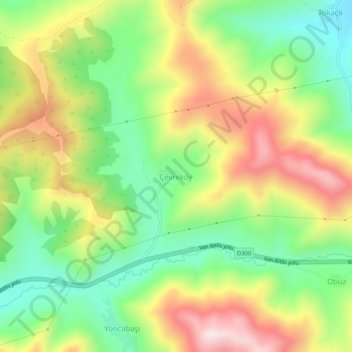
Name: Çevreköy topographic map, elevation, terrain.
Location: Çevreköy, Tatvan, Bitlis, Oost-Anatolië, Turkije (38.43897 42.33767 38.47897 42.37767)
Average elevation: 1,898 m
Minimum elevation: 1,669 m
Maximum elevation: 2,194 m
Thank you for supporting this site ❤️
Make a donation
Make a donation
Gear up for your next adventure:
As an Amazon Associate, this site earns from qualifying purchases at no extra cost to you.