
Thank you for supporting this site ❤️
Make a donation
Make a donation
Gear up for your next adventure:
As an Amazon Associate, this site earns from qualifying purchases at no extra cost to you.
Golubić topographic map
Click on the map to display elevation.
Thank you for supporting this site ❤️
Make a donation
Make a donation
Gear up for your next adventure:
As an Amazon Associate, this site earns from qualifying purchases at no extra cost to you.
About this map
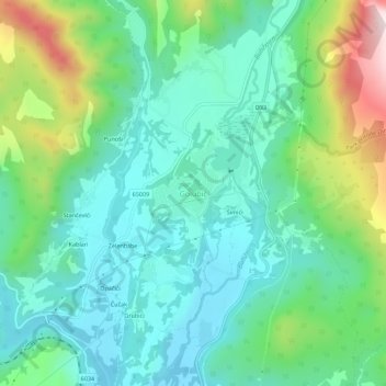
Name: Golubić topographic map, elevation, terrain.
Location: Golubić, Grad Knin, Šibenik-Knin County, 22301, Croatia (44.07638 16.19785 44.11638 16.23785)
Average elevation: 368 m
Minimum elevation: 231 m
Maximum elevation: 746 m
Thank you for supporting this site ❤️
Make a donation
Make a donation
Gear up for your next adventure:
As an Amazon Associate, this site earns from qualifying purchases at no extra cost to you.