Geolocate

Paratushiali topographic map

Click on the map to display elevation.

About this map

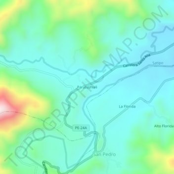
Name: Paratushiali topographic map, elevation, terrain.

Location: Paratushiali, Satipo, Junín, Perú (-11.31055 -74.72030 -11.27055 -74.68030)

Average elevation: 821 m

Minimum elevation: 694 m

Maximum elevation: 1,279 m

Other topographic maps

Click on a map to view its topography, its elevation and its terrain.

Plaza Mayor de Satipo

Perú > Junín > Satipo

Average elevation: 669 m

Plaza de Armas Santa Leonor

Perú > Junín > Satipo

Average elevation: 637 m

Gear up for your next adventure:

🍽️Titanium Camping Spork - Ultralight and indestructible eating utensil
🛶Kayak Accessories - Essential gear for safe and fun kayaking adventures
🧦Crew Hiking Socks - Comfortable socks for long-distance hikes
🔦LED Headtorch - Bright and durable light for night activities
🥾Waterproof Hiking Boots - Essential footwear for rugged terrain and wet Canadian trails

As an Amazon Associate, this site earns from qualifying purchases at no extra cost to you.