
Make a donation
Gear up for your next adventure:
As an Amazon Associate, this site earns from qualifying purchases at no extra cost to you.
Les Mureaux topographic map
Click on the map to display elevation.
Make a donation
Gear up for your next adventure:
As an Amazon Associate, this site earns from qualifying purchases at no extra cost to you.
Les Mureaux
Le territoire s'étend à partir des bords de Seine dans la basse plaine alluviale de la Seine, en légère pente vers le nord, les altitudes s'échelonnant entre 38 mètres à l'extrême sud de la commune et 20 mètres sur la rive du fleuve.
Make a donation
Gear up for your next adventure:
As an Amazon Associate, this site earns from qualifying purchases at no extra cost to you.
About this map
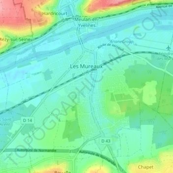
Name: Les Mureaux topographic map, elevation, terrain.
Average elevation: 39 m
Minimum elevation: 16 m
Maximum elevation: 116 m
Make a donation
Gear up for your next adventure:
As an Amazon Associate, this site earns from qualifying purchases at no extra cost to you.