
Northwest Harbor topographic map
Click on the map to display elevation.
About this map
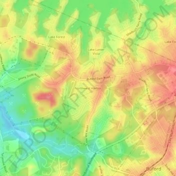
Name: Northwest Harbor topographic map, elevation, terrain.
Average elevation: 340 m
Minimum elevation: 292 m
Maximum elevation: 383 m
Other topographic maps
Click on a map to view its topography, its elevation and its terrain.
Bogan Park
United States > Georgia > Gwinnett County > Buford > Springlake Estates
Average elevation: 354 m