
Thank you for supporting this site ❤️
Make a donation
Make a donation
Gear up for your next adventure:
As an Amazon Associate, this site earns from qualifying purchases at no extra cost to you.
Cantone topographic map
Click on the map to display elevation.
Thank you for supporting this site ❤️
Make a donation
Make a donation
Gear up for your next adventure:
As an Amazon Associate, this site earns from qualifying purchases at no extra cost to you.
About this map
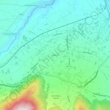
Name: Cantone topographic map, elevation, terrain.
Location: Cantone, Introdacqua, L'Aquila, Abruzzo, 67030, Italia (42.01644 13.87065 42.05644 13.91065)
Average elevation: 472 m
Minimum elevation: 338 m
Maximum elevation: 929 m
Thank you for supporting this site ❤️
Make a donation
Make a donation
Gear up for your next adventure:
As an Amazon Associate, this site earns from qualifying purchases at no extra cost to you.