
Braemar topographic map
Click on the map to display elevation.
Braemar
Braemar /breɪˈmɑːr/ is a village in Aberdeenshire, Scotland, around 58 miles (93 km) west of Aberdeen in the Highlands. It is the closest significantly-sized settlement to the upper course of the River Dee, sitting at an elevation of 339 metres (1,112 ft).
About this map
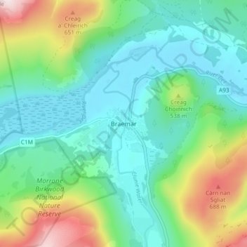
Name: Braemar topographic map, elevation, terrain.
Location: Braemar, Aberdeenshire, Scotland, AB35 5YN, United Kingdom (56.98582 -3.41971 57.02582 -3.37971)
Average elevation: 445 m
Minimum elevation: 317 m
Maximum elevation: 789 m
Other topographic maps
Click on a map to view its topography, its elevation and its terrain.
Chapelton of Elsick
United Kingdom > Scotland > Aberdeenshire
House styles in Chapelton vary from small apartments to five bedroom family homes. The architecture of the houses' exteriors have slate roof tiles and lime harl. Architectural details and materials in the first phase include slate roofs, timber windows (sash and case to public elevations), Dormer|dormer…
Average elevation: 93 m