
Busso topographic map
Interactive map
Click on the map to display elevation.
About this map
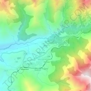
Name: Busso topographic map, elevation, terrain.
Average elevation: 854 m
Minimum elevation: 450 m
Maximum elevation: 1,651 m
Other topographic maps
Click on a map to view its topography, its elevation and its terrain.
Puggiarellu
France > Corse > Corse-du-Sud > Bocognano
Puggiarellu, Bocognano, Ajaccio, Corse-du-Sud, Corse, France métropolitaine, 20136, France
Average elevation: 821 m