Geolocate

Montana topographic map

Click on the map to display elevation.

About this map

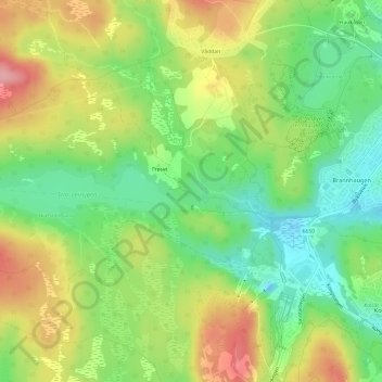
Name: Montana topographic map, elevation, terrain.

Location: Montana, Frøset, Midtbyen, Trondheim, Trøndelag, 7024, Norway (63.37448 10.28653 63.39448 10.30653)

Average elevation: 218 m

Minimum elevation: 161 m

Maximum elevation: 291 m

Gear up for your next adventure:

🥾Light Trekking Boots - Supportive boots for multi-day treks
🥾Hiking Boots - Sturdy boots providing ankle support and traction on rugged trails
🧦Hiking Socks - Moisture-wicking and comfortable socks for long hikes
🧰Multitool Knife - Compact and versatile tool for outdoor use
🔭Outdoor Binoculars - Lightweight binoculars for birdwatching and hiking

As an Amazon Associate, this site earns from qualifying purchases at no extra cost to you.