Geolocate

Mount Una topographic map

Click on the map to display elevation.

About this map
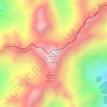
Name: Mount Una topographic map, elevation, terrain.

Location: Mount Una, Hurunui District, New Zealand (-42.21687 172.58516 -42.21677 172.58526)

Average elevation: 1,816 m

Minimum elevation: 1,159 m

Maximum elevation: 2,270 m

Other topographic maps

Click on a map to view its topography, its elevation and its terrain.

Organ Range

New Zealand > Hurunui District

Average elevation: 816 m

Lake Guyon

New Zealand > Hurunui District

Average elevation: 982 m

Gear up for your next adventure:

🔪Outdoor Multitool - Versatile tool for repairs and food prep in the wild
🧦Hiking Socks - Moisture-wicking and comfortable socks for long hikes
🛁Quick-Dry Microfiber Towel - Space-saving towel that dries rapidly on the move
🧰Survival Kit - Essential gear for emergencies in the wilderness
🗺️Topographic Maps - Detailed maps to explore trails, mountains, and wilderness areas

As an Amazon Associate, this site earns from qualifying purchases at no extra cost to you.