Geolocate

Shedol topographic map

Click on the map to display elevation.

About this map

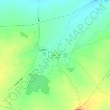
Name: Shedol topographic map, elevation, terrain.

Location: Shedol, Nilanga, Latur, Maharashtra, 413521, India (18.17870 76.62846 18.21870 76.66846)

Average elevation: 619 m

Minimum elevation: 598 m

Maximum elevation: 653 m

Gear up for your next adventure:

🔦LED Headtorch - Bright and durable light for night activities
🍽️Titanium Camping Spork - Ultralight and indestructible eating utensil
👟Sport Hiking Sandals - Breathable footwear for water crossings and camp rest
🛏️Camping Sleeping Mat - Comfortable mats for sleeping outdoors
🛶Canoe Life Vest - Safety vest for water sports

As an Amazon Associate, this site earns from qualifying purchases at no extra cost to you.